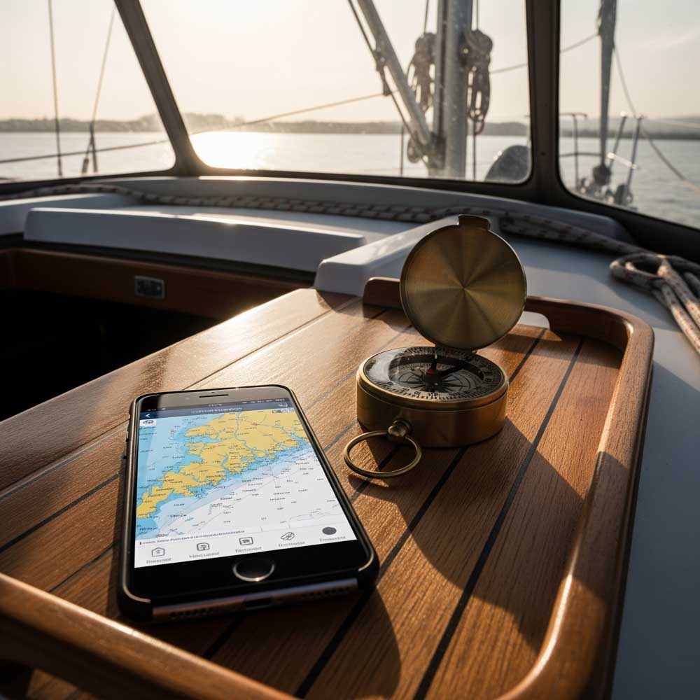
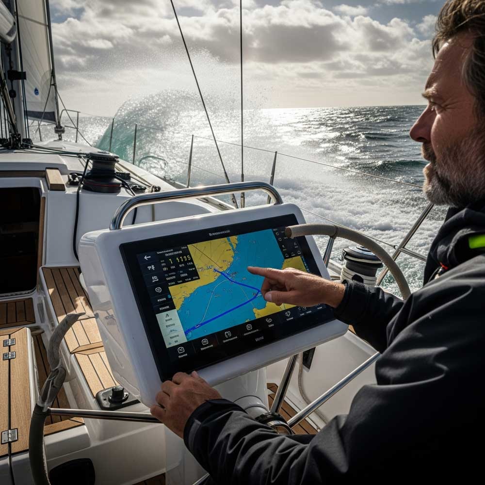
Why Digital Navigation Matters
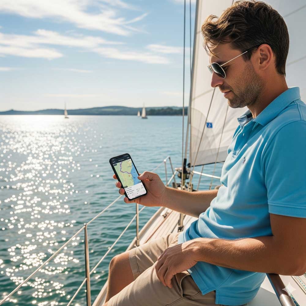
Let’s be honest—paper charts still have their place, but they’re no match for a waterproof tablet, or even mobile, running a smart sailing navigation app when you’re dodging fish farms in the Med or picking through fog in the Solent. Digital tools have gone from backup to baseline. Whether you’re plotting weekend hops or crossing oceans, marine navigation apps bring real-time positioning, tide data, weather overlays, and passage planning into your pocket.
Many newer sailors rely exclusively on apps. And for good reason—they’re cheaper than chartplotters, more frequently updated, and ideal for smaller vessels. Add a waterproof case, an external GPS puck if needed, and you’ve got a serious bit of kit. But the range of apps is now vast. Which to trust?
I’ve spent recent years and this season testing and comparing the top options. Some are elegant and intuitive; others are cluttered but powerful. Some thrive offline; others need constant signal.
Choosing the right app is as personal as choosing the right vessel. It’s about trust, feel, and fitness for purpose. While the digital sea is vast, a true skipper’s toolkit focuses on proven, reliable tools. This guide focuses on the titans of the industry and the essential specialists—the ones you’ll hear talked about in yacht clubs from the Solent to the Hauraki Gulf. An expert’s guide isn’t just about the biggest names; it’s about the right tools for the job.
Here is the salt-tested truth on the twelve apps that will guide you home.
Top 12 Sailing Navigation Apps Reviewed
1. Garmin Boating (Navionics): The Global Benchmark
Long before it was part of the Garmin empire, Navionics was the name whispered with reverence in navigation stations worldwide. It remains the standard by which all others are judged, and for good reason. Its power lies in its seamless blend of intuitive design and profound depth. If you can use a map on your phone to find a coffee shop, you can plot a course to the Bahamas. The learning curve is gentle, yet the features run deep, rewarding those who take the time to explore. Its rock-solid offline availability, allowing you to download vast and detailed chart regions, makes it a tool built for true self-sufficiency.
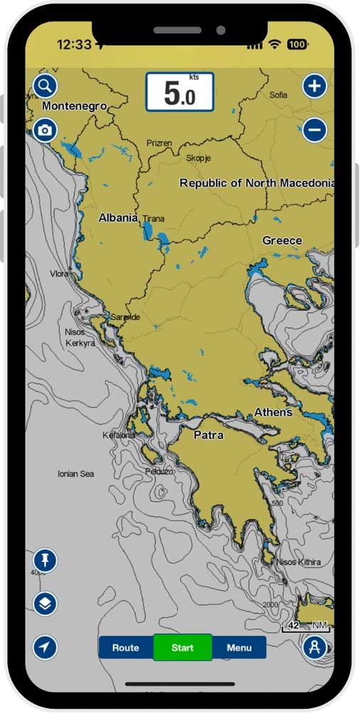
The charts themselves are primarily vector, a proprietary blend of official hydrographic office data enriched by Garmin’s surveys and an immense database of user-generated soundings called SonarChart™. This creates charts with unparalleled bottom detail in many areas, which can be customized to an almost obsessive degree by overlaying satellite imagery or relief shading. The “Dock-to-dock Autorouting” is genuinely remarkable, but its secret weapon is the ActiveCaptain community—a massive, crowd-sourced database of local knowledge on anchorages and marinas. It’s like having the advice of thousands of local sailors in your pocket. At around $25-$70 per year, its subscription feels like a fair price for what is, for many, the one app to rule them all.
2. Aqua Map: The US Coastal & Inland Specialist
For anyone cruising the Intracoastal Waterway (ICW), the Great Loop, or the shifting channels of the US coastline, Aqua Map isn’t just an option; it’s a necessity. It’s a tool built with a deep understanding of the unique challenges of American waters, presenting critical information with a clean, uncluttered interface.
Its power comes from its charts. While built on official NOAA vector charts, its killer feature is the ability to download and overlay the latest U.S. Army Corps of Engineers (USACE) hydrographic surveys. This provides the most up-to-date picture of shifting channels and shoaling available anywhere—a critical safety advantage. It fully integrates with Waterway Guide and ActiveCaptain data, providing a rich source of local knowledge. With a one-time purchase model for chart regions and an optional low-cost subscription for pro features, Aqua Map delivers immense and highly specialized value.
3. iNavX: The Professional’s Power Tool
iNavX feels like it was born in a commercial wheelhouse. It’s less of a single “app” and more of a powerful charting engine, prized by serious offshore sailors and delivery skippers for its flexibility and raw capability. Be warned, the learning curve is steep; this is not a pick-up-and-go app. Its interface is dense, packed with options that offer unparalleled control for advanced users.
Its greatest strength is its chart versatility, supporting a huge array of vector and raster charts from providers like Navionics, C-MAP, and official hydrographic offices. But its defining feature is its ability to act as a repeater for your boat’s instruments via a WiFi connection, displaying live AIS targets, depth, and wind data directly on the chart. For the sailor who wants to turn their tablet into a true command center and integrate complex GRIB weather files for passage planning, iNavX is in a class of its own.
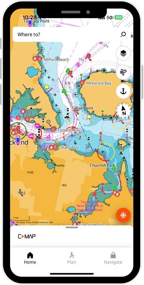
4. C-MAP: The Polished Global Challenger
C-MAP has long been the primary rival to Navionics, and their mobile sailing navigation app is a formidable and beautifully designed contender. From the moment you open it, the experience feels modern, fast, and intuitive. Many users find its chart presentation cleaner and more aesthetically pleasing than competitors, built on high-quality vector charts from their own extensive global database.
A premium subscription unlocks the app’s full potential, with unlimited offline map downloads, advanced features like AIS and relief shading, and a very capable Autorouting function. Its weather integration is particularly well-executed, allowing you to view forecasts and conditions along your planned route. C-MAP is a slick, powerful, and complete global navigator that offers a genuine alternative to the top dog.
5. Savvy Navvy: The Smart Navigator
Born in the UK to solve the complex problems of tidal navigation, Savvy Navvy feels like the future. It’s less a digital chart and more a holistic passage-planning partner. Its tagline is “Google Maps for boats,” and it lives up to it with a clean, modern interface focused on clear answers. The vector charts are simplified for readability, which some traditionalists may find lacks detail, but many find refreshingly easy to use.
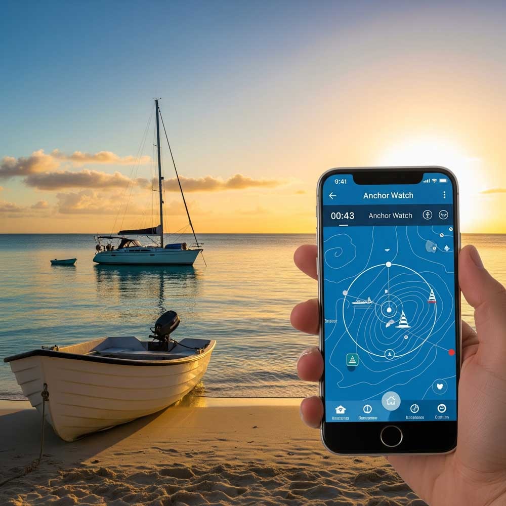
Its revolutionary feature is the “Departure Scheduler.” When you plot a route, the app uses weather forecasts and tidal stream data to show you the best time to leave, calculating your ETA and course-to-steer based on the conditions. Originally focus on Europe but many don’t realise Savvy Navvy has now spread its wings significantly with distribution and coverage globally (and another good thing is that the subscription is not linked to a chart area like some others, so you can get chart for anywhere globally under the same subscription). Further, Savvy Navvy uses a hybrid ECMWF forecast and GFS which the user can switch between. And for cruisers, don’t forget the Anchor alarm feature, which is great for peace of mind when in an untested anchorage
6. OpenCPN: The Open-Source Workhorse
OpenCPN is not a commercial product and is only available for Mac OSX, Microsoft Windows, GNU/Linux, BSDs and Solaris; it’s a community-driven project built by sailors, for sailors. For the technically inclined boater who loves to tinker, it’s a powerful and completely free alternative. It requires significant setup and has a steep learning curve, but the payoff is a completely customizable, self-contained offline system. It can use a wide variety of free vector and raster charts, such as those from NOAA, and is infinitely expandable through a vast library of user-created plugins for everything from weather routing to advanced instrument dashboards. OpenCPN is an embodiment of the self-sufficient sailing spirit, a testament to what a passionate community can build.
7. Imray Navigator: The Traditionalist’s Choice
For sailors who grew up with Imray’s iconic blue-bordered paper charts, this sailing navigation app feels like coming home. It brings the clarity and trusted cartography of the legendary publisher to the digital world. This is a basic, reliable chart plotter that focuses on doing the fundamentals perfectly, using Imray’s award-winning raster charts—digital versions of the beautiful paper charts themselves. The appeal is the unmatched clarity of the underlying chart, not heavy customisation. For a simple, elegant, and trusted navigation experience that honours the art of cartography, Imray Navigator is a beautiful choice.
8. CAptains Mate: The Essential Companion
CAptain’s Mate by the Cruising Association (CA), much like a trusted analogue backup on your chart table, strips away the digital noise to focus on core navigation. It’s not about overwhelming you with layers of data or complex algorithms, but rather about providing clear, reliable access to essential information. Think of it as your digital compass and logbook, perfectly suited for those who appreciate the fundamentals without the bells and whistles.
Its charts are typically vector, derived from standard hydrographic office data, offering clear and concise detail. The app’s strength lies in its ease of use; the interface is incredibly straightforward, allowing even novice navigators to quickly grasp their position, course, and speed. You won’t find intricate autorouting here, but its route planning is solid and intuitive for manually plotting waypoints and recording your tracks. Offline availability is a key feature, allowing you to download chart areas for reliable use beyond cellular range, crucial for any serious outing. Customisation is kept to a minimum, ensuring a clean and uncluttered display that prioritises readability.
When it comes to price, CAptain’s Mate often falls into a low to mid-tier range, sometimes offering a one-time purchase or a very modest subscription, making it an accessible option. While it provides fundamental weather and tide information, it generally doesn’t boast the deep, integrated forecasting of more specialized apps. You won’t find extensive community features like live sharing or data exchange, as its design philosophy leans more towards personal, self-reliant navigation. It is generally available on both iOS and Android, ensuring broad compatibility for most users. Captain’s Mate is the reliable, no-nonsense choice for those who want their navigation precise, uncluttered, and always at their fingertips.
Sailing Navigation Apps Comparison Table
Here’s the quick‑look summary—chart quality, offshore routing, tidal data, offline capability, and affordability:
| App Name | Charts Type | Route Planning | Ease of Use | Feature Richness | Offline Use | Price Tier |
| Garmin (Navionics) | Vector (Proprietary) | Excellent (Autorouting) | Excellent | Very High | Excellent | Mid (Subscription) |
| Aqua Map | Vector (NOAA/USACE) | Good | Excellent | Mid (US Niche) | Excellent | Low (One-time Buy) |
| iNavX | Vector & Raster | Advanced | Low (Steep Curve) | Very High (NMEA) | Excellent | High (App + Charts) |
| C-MAP | Vector (Proprietary) | Excellent (Autorouting) | Excellent | High | Excellent | Mid (Subscription) |
| Savvy Navvy | Vector (Simplified) | Excellent (Tidal) | Excellent | High (Holistic) | Good | Mid-High (Sub) |
| OpenCPN | Vector & Raster | Good (Functional) | Low (DIY Setup) | Very High (Plugins) | Excellent | Free (Open Source) |
| Imray Navigator | Raster | Basic | Excellent | Low (Chart Focus) | Excellent | Low-Mid (Folios) |
| CAptains Mate | Vector | Low (Pilotage Focus) | Excellent | Specialized (Local) | Good | Low |
Recommendations by Sailor Type
Weekend Explorer
You’re driven by spontaneity. The plan is often “wherever the wind takes us,” as long as it gets you back to the marina by Sunday evening. You need an app that is as fast and easy as casting off the lines. Your primary tool should be Savvy Navvy. Its intuitive, “Google Maps for boats” interface removes all friction. Plotting a quick course to that cove you’ve always wanted to visit is a matter of seconds, and its brilliant departure scheduler, which factors in wind and tides, can turn a choppy bash into a pleasant reach, even on a short trip. Or alternatively both Imray Navigator and CAptains Mate also ticks the boxes: light interface, great offline use, and easy waypointing. Perfect for surfing new anchorages without breaking the bank.
Cruising Enthusiast
You live for the journey. You’re out for weeks or months at a time, and your boat is your second home. For you, the digital chart table is your mission control, and it needs to be comprehensive, reliable, and rich with information. Your go-to app is, without question, Garmin (Navionics). It’s the global standard for a reason. The depth of its charts, the power of its autorouting, and the sheer wealth of local knowledge in the ActiveCaptain community are unmatched. It’s the trusted companion for discovering new cruising grounds.
With Savvy Navvy spreading globally it is becoming a strong contender in this area now. As a discerning alternative, consider C-MAP. It offers a similarly powerful global feature set but with a different, often cleaner, chart presentation that many experienced cruisers prefer. And if your cruising is focused exclusively on US waters, Aqua Map becomes a top contender for its invaluable integration of USACE survey data.
Coastal Family Skipper
Your priorities are safety, simplicity, and creating wonderful memories. The navigation app needs to be foolproof, providing clear, unambiguous guidance that lets you focus on your crew and the scenery. Either Garmin (Navionics) or C-MAP will serve you perfectly. Their best-in-class autorouting features act as a brilliant “second opinion,” helping you thread your way through unfamiliar channels and find the safest path into a new harbour. The interfaces are clean and easily understood by everyone on board, and the vast databases of marina information make planning a family-friendly stop a breeze.
Offshore Passage Maker
When the coast disappears over the horizon, your app ceases to be a convenience and becomes a critical piece of survival equipment. You require absolute reliability and advanced, professional-grade data. Your primary navigator must be iNavX. Its ability to connect to your boat’s NMEA network via WiFi is non-negotiable, turning your tablet into a true repeater for live AIS, wind, and depth data. Its support for a vast array of official vector and raster charts and its advanced GRIB weather file integration make it the ultimate tool for strategic, long-distance passage planning.
For the tech-savvy and budget-conscious sailor, OpenCPN offers a powerful, customizable, and free alternative, provided you have the patience for its steep learning curve.
Anchoring and Day‑Charters
Your world is the local coastline, and your expertise is in knowing all the best nooks and crannies. Your digital tool should reflect that hyper-local focus. Your secret weapon is CAptains Mate. It is purpose-built for sharing and receiving the kind of granular, on-the-ground knowledge that makes a good anchorage great. The user-submitted photos of tricky entrances and detailed reviews of holding ground are more valuable than any official chart for this kind of boating.
To complement this, Garmin (Navionics) is an excellent choice due to its massive ActiveCaptain database, which serves a similar function. Alternatively if you want the look and feel of the paper charts then why not use Imray Navigator. If you’re chartering in the US, Aqua Map is also a superb tool, as its detailed survey data can help you confidently tuck into shallow spots that others might avoid. Then finally, again Savvy Navvy is a must add to the list for anchoring.
Read Next
Ready to Set Sail? Download my FREE Bareboat Charter Handover Guide, subscribe for monthly tips, and explore hand‑picked sailing gear to make your journey easier. Your adventure starts now.