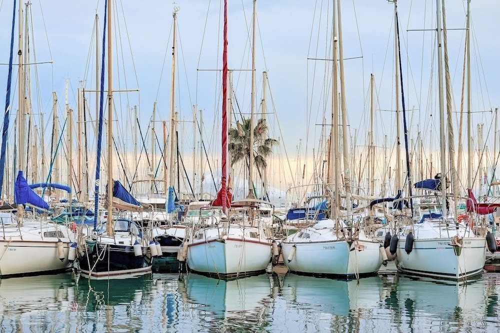
This seven-day Mallorca sailing route links Palma’s Gothic skyline with Andratx’s sunset bay, Sóller’s horseshoe harbour, and the north coast’s wild cliffs. Swim in quiet anchorages near Betlem, explore Porto Cristo’s famous caves, then finish with a protected night on Cabrera’s mooring buoys before sailing back to Palma.
7 days
167 nautical miles
Palma de Mallorca ➔Port d’Andratx ➔ Port de Sóller ➔ Cala Sant Vicenç ➔ Betlem ➔ Porto Cristo ➔ Cabrera National Park ➔ Palma de Mallorca
Highlights
Relaxed Mallorca sailing loop with short to medium coastal hops, Tramuntana mountain backdrops, quiet anchorages, Porto Cristo caves, and starry Cabrera nights.
Overview
Mallorca’s coastline feels purpose-built for a week of relaxed coastal sailing. Distances are civilised, the scenery shifts every day, and you can still find quiet corners between the big-name ports. Palma gives you a proper city send-off, with its cathedral towering above the harbour and marinas offering full services before you cast off. Your Mallorca Sailing itinerary is a full circumnavigation of the island that runs clockwise from Palma to the southwest, skirting pine-covered headlands into Port d’Andratx, then along the Tramuntana mountains to Sóller, the only all-weather harbour on the north-west coast. From there, you trace the north coast towards Cala Sant Vicenç and the Bay of Alcúdia, with time to drop the hook near quieter villages like Betlem and Colònia de Sant Pere. On the east, Porto Cristo adds a touch of drama with limestone caves and a snug marina. Finally, you reach Cabrera National Park, a protected island group where you must pre-book a buoy and anchoring is restricted to protect seagrass beds. One evening there, I misjudged dinner timing and ended up eating slightly burnt pasta in the cockpit while the sky exploded with stars. No one complained; the view did all the work.
Special Gems
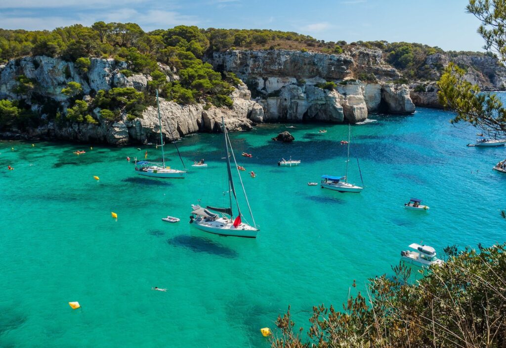
Hidden gems abound. Cala Tuent north of Sóller is a locals’ favourite—excellent holding and a single family-run restaurant. Cala Mondragó sits within a nature reserve and makes a delightful lunch anchorage. For food lovers, the market at Santanyí offers artisanal cheese and Mallorcan sea salt worth stocking up on. Festivals add sparkle: Pollença’s Patrona in early August fills the port with fireworks and mock pirate battles (worth timing your visit). Andratx hosts live music most weekends in summer. For nature, Cabrera’s bioluminescent plankton can surprise you—swirl your hand through the water after dark, and the sea glows softly back. It’s one of those moments that remind you why we sail: not for distance or speed, but for magic between sky and sea.
Several side trips also could fit neatly within this Mallorca Sailing itinerary. From Port d’Andratx or Sóller, guided hiking in the Tramuntana range gives you a different angle on the coast you’ve just sailed, with routes ranging from easy walks to more committed day hikes.
Around the north-east, Artà and nearby inland villages offer historic centres, hilltop sanctuaries, and local markets. From Porto Cristo, you can combine the caves with a short inland excursion for wine tasting or rural restaurants. Events vary each year, but typical highlights include summer music festivals in Pollença and local fiestas in many coastal towns; always verify current-year schedules before planning around a particular event.
For crews with extra time in Palma, consider a day trip by land or organised boat to Es Trenc beach for a long strip of sand and clear water, or a training day with one of the local sailing schools to brush up on Med-mooring, reefing, or night navigation skills.
Passage Conditions & Navigation Profile
Summer winds moderate to stronger from the north or northeast. Tides, very small
Read MoreLess
Weather, sea, wind considerations: In summer around Mallorca winds tend to be gentle to moderate — generally 5–15 knots — ideal for relaxed sailing. Occasionally, stronger winds arise from the north or northeast (known as Tramontana or Gregal), bringing gusts and choppy seas, especially in cooler seasons. Swells remain modest in summer, with sea fairly calm in most anchorages.
Level of navigation required: For island-hopping along the coast or between nearby anchorages, line-of-sight navigation is usually sufficient. However, when crossing open stretches or navigating tighter bays and reefs — especially under stronger wind or swell — a prepared navigation plan using up-to-date charts is recommended for safety.
Tides and currents: Tidal range around Mallorca is very small — tides generally rise and fall only by a few decimetres, making tidal effects negligible for most sailing and anchoring. There are no major known tidal gates or strong current zones in typical sailing areas, and currents are weak under normal conditions.
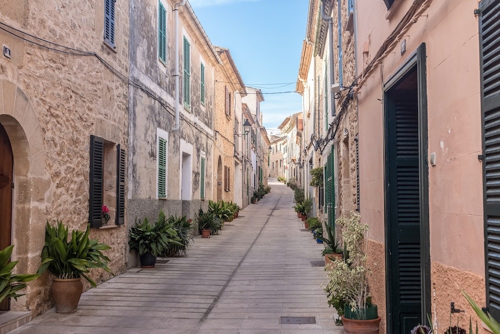
Day 1 – Palma de Mallorca to Port d’Andratx
You cast off from Palma with the cathedral behind you and a forest of masts all around. Leaving the bay, the city softens into low coastline, then the headlands of the southwest start to shape the horizon. It’s a relaxed first leg for Mallorca Sailing, with clear water and plenty of traffic to keep you alert but not stressed. Port d’Andratx itself feels like a natural amphitheatre: steep hillsides dotted with villas, fishing boats near the quay, and a line of restaurants hugging the waterfront. The harbour is well-protected, with Club de Vela’s pontoons tucked in behind the breakwater and many moored yachts facing the sunset. It’s the sort of place where you arrive planning a quiet night on board but end up wandering ashore “just for one drink”, and somehow dessert appears too.
18.5 nautical miles
3hrs sailing time
LUNCH STOP:none planned
MOORING:Club de Vela marina berths and town quay; contact marina for 2025 rates and advance reservations.
Description
You cast off from Palma with the cathedral behind you and a forest of masts all around. Leaving the bay, the city softens into low coastline, then the headlands of the southwest start to shape the horizon. It’s a relaxed first leg for Mallorca Sailing, with clear water and plenty of traffic to keep you alert but not stressed. Port d’Andratx itself feels like a natural amphitheatre: steep hillsides dotted with villas, fishing boats near the quay, and a line of restaurants hugging the waterfront. The harbour is well-protected, with Club de Vela’s pontoons tucked in behind the breakwater and many moored yachts facing the sunset. It’s the sort of place where you arrive planning a quiet night on board but end up wandering ashore “just for one drink”, and somehow dessert appears too.
Attractions
Once you’re tied up, a stroll along the waterfront is almost mandatory. The promenade curves around the harbour, lined with cafés and restaurants, including the Club de Vela restaurant with its terrace overlooking the basin. If you have time, short hikes in the surrounding hills reveal viewpoints back over the bay and out towards Sa Dragonera island, which is a protected natural park accessible by excursion boats from nearby Sant Elm. Shore-side, Andratx town itself lies slightly inland, with galleries and a weekly market reachable by taxi. It’s easy to fit in provisioning here thanks to supermarkets behind the harbour. Between the marina and the village you’ll find small coves for afternoon swims, though many crews are perfectly happy to swim off the stern in the protected inner harbour.
Cautions
Busy harbour with traffic; watch wash from motor yachts and ferries on weekends and in high season.
Facilities
Water, fuel, electricity, showers, Wi-Fi, supermarket, bar-restaurant, launderette, basic medical and pharmacy access in town.
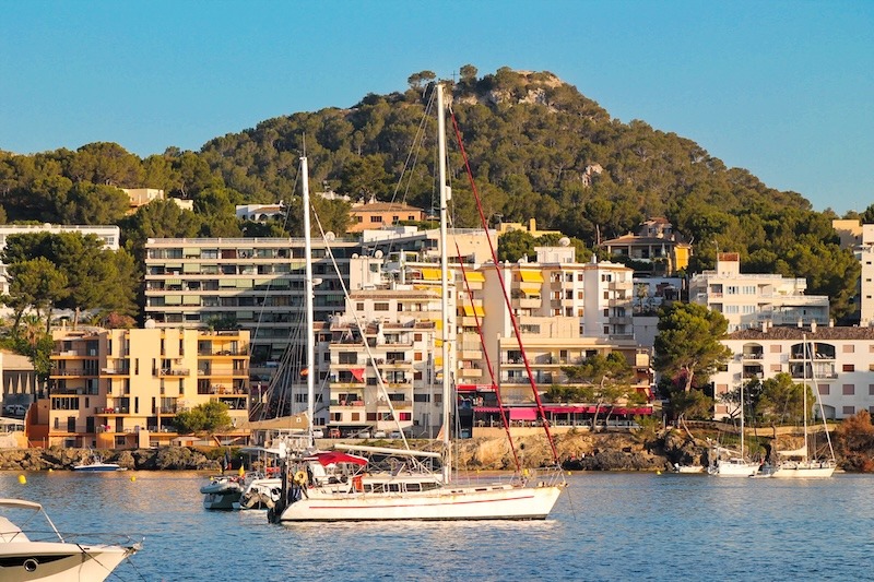
Day 2 – Port d’Andratx to Port de Sóller
This leg is one of the highlights of Mallorca Sailing: the Tramuntana mountains run parallel to your track, rising steeply from the sea. Head north along a rugged coast of cliffs, caves, and occasional watchtowers, with very few all-weather refuges, which makes Sóller feel like a welcome bolt-hole when it appears ahead. Port de Sóller is a near-perfect horseshoe bay. Forested slopes frame the water, lighthouses stand on rocky points at the entrance, and a mix of fishing craft and yachts line the waterfront. The resort itself feels gentler than some bigger Mallorca towns, with a beach curving around the inner bay and low-rise buildings. Two marinas share the harbour, plus moorings run by the port authority. There’s usually someone ready to wave you in and hand you a lazy line, often with a grin that says they’ve seen every version of a wonky Med-moor.
24 nautical miles
4hrs 30mins sailing time
LUNCH STOP:none planned
MOORING:Port IB pontoons and private marinas; water and power included in mooring; check current tariffs before arrival.
Description
This leg is one of the highlights of Mallorca Sailing: the Tramuntana mountains run parallel to your track, rising steeply from the sea. Head north along a rugged coast of cliffs, caves, and occasional watchtowers, with very few all-weather refuges, which makes Sóller feel like a welcome bolt-hole when it appears ahead. Port de Sóller is a near-perfect horseshoe bay. Forested slopes frame the water, lighthouses stand on rocky points at the entrance, and a mix of fishing craft and yachts line the waterfront. The resort itself feels gentler than some bigger Mallorca towns, with a beach curving around the inner bay and low-rise buildings. Two marinas share the harbour, plus moorings run by the port authority. There’s usually someone ready to wave you in and hand you a lazy line, often with a grin that says they’ve seen every version of a wonky Med-moor.
Attractions
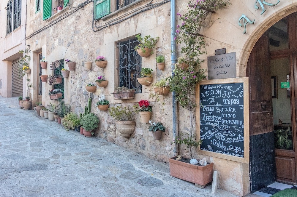
Port de Sóller makes a cracking base for exploring inland. The vintage wooden tram runs regularly between the port and Sóller town, where you can wander narrow streets, visit the church on the main square, or sit with coffee and watch mountain light change. Around the bay you’ll find several beaches, boat excursions, and access to hiking routes into the Tramuntana, including sections of the GR-221 trail. For something gentler, there are waterfront restaurants and bars, ice-cream stalls, and a small maritime museum. One time I came in slightly early, thinking the place would be sleepy; instead, the waterfront was buzzing with families, joggers, and sailors comparing notes about squalls they’d dodged on the north-west coast.
Cautions
Entrance uncomfortable with strong N or NE winds and swell; check forecasts carefully before committing to this leg.
Facilities
Water, fuel, electricity, showers, Wi-Fi, groceries, restaurants, car rental, medical clinic and pharmacy in town.
Day 3 – Port de Sóller to Cala Sant Vicenç
Leaving Sóller, you continue along the north coast, with more cliffs, occasional ravines, and the odd goat track zig-zagging up hillsides. In settled weather this is a glorious Mallorca Sailing day, but the coast is exposed, so you want a decent forecast in your pocket. Cala Sant Vicenç sits tucked into the northeastern corner of the Tramuntana, a small resort with several sandy coves surrounded by low cliffs and hotel terraces. You’ll usually anchor rather than moor, dropping in sand with good holding in calm or moderate conditions. The water is clear and invites a swim before you decide which restaurant balcony looks most tempting. It feels smaller and quieter than nearby Port de Pollença, yet you’re not far away from bigger-town facilities if needed.
20 nautical miles
3hrs 30mins sailing time
LUNCH STOP:none planned
MOORING:Anchorage in Cala Sant Vicenç in settled weather; no organised marina berths, use nearby Port de Pollença.
Description
Leaving Sóller, you continue along the north coast, with more cliffs, occasional ravines, and the odd goat track zig-zagging up hillsides. In settled weather this is a glorious Mallorca Sailing day, but the coast is exposed, so you want a decent forecast in your pocket. Cala Sant Vicenç sits tucked into the northeastern corner of the Tramuntana, a small resort with several sandy coves surrounded by low cliffs and hotel terraces. You’ll usually anchor rather than moor, dropping in sand with good holding in calm or moderate conditions. The water is clear and invites a swim before you decide which restaurant balcony looks most tempting. It feels smaller and quieter than nearby Port de Pollença, yet you’re not far away from bigger-town facilities if needed.
Attractions
The main attractions here are simple: beaches, swimming, and coastal walks. Cala Barques and Cala Molins are the best-known coves, each with a strip of sand and clear water for snorkelling. Onshore, you’ll find a handful of restaurants and bars with sea views, which make good sunset spots. For wider exploring, Pollença town is within a short taxi or bus ride. There you can climb the Calvario steps, wander art galleries, or enjoy the Sunday market in the main square. If the crew feels restless, Port de Pollença’s larger waterfront and marina are close enough for a lunch run or supplies, then you can slip back to the quieter anchorage by evening.
Cautions
Exposed to northerly swell and strong winds; avoid in heavy seas, consider Port de Pollença instead.
Facilities
Small resort: restaurants, limited groceries, some hotels; main chandlery, fuel, and bigger shops at Port de Pollença.
Day 4 – Cala Sant Vicenç to Betlem (Bay of Alcúdia)
You round Cap de Formentor and ease into the more open waters of the Bay of Alcúdia. The high cliffs give way to gentler slopes and longer beaches. Depending on wind angle, this can be a lovely reaching day, with enough room to tweak sail trim without constantly dodging rocks. The Betlem and Colònia de Sant Pere area feels like a step down in tempo after the north coast. Expect a small marina, low-rise houses, and a quiet promenade instead of a big resort strip. Anchoring off in settled conditions lets you enjoy views of both the bay and the Tramuntana fading behind you. On a good evening the water is flat, the hills glow in soft light, and the loudest thing you hear is cutlery from the waterfront terrace. There are of course a number of alternative spots to target for your evening anchorage in this area. For example you could drop about 2Nm southwest to the small town of Colònia de Sant Pere for a slightly more restaurants and other facilities
21 nautical miles
3hrs 30mins sailing time
LUNCH STOP:none planned
MOORING:Anchorage off Colònia de Sant Pere/Betlem in settled weather; small local harbour, confirm berth availability in advance.
Description
You round Cap de Formentor and ease into the more open waters of the Bay of Alcúdia. The high cliffs give way to gentler slopes and longer beaches. Depending on wind angle, this can be a lovely reaching day, with enough room to tweak sail trim without constantly dodging rocks. The Betlem and Colònia de Sant Pere area feels like a step down in tempo after the north coast. Expect a small marina, low-rise houses, and a quiet promenade instead of a big resort strip. Anchoring off in settled conditions lets you enjoy views of both the bay and the Tramuntana fading behind you. On a good evening the water is flat, the hills glow in soft light, and the loudest thing you hear is cutlery from the waterfront terrace. There are of course a number of alternative spots to target for your evening anchorage in this area. For example you could drop about 2Nm southwest to the small town of Colònia de Sant Pere for a slightly more restaurants and other facilities
Attractions
Colònia de Sant Pere offers simple pleasures: a sandy beach, peaceful promenade, and a couple of small harbourside restaurants. The shallow water near the beach suits swimming and paddleboarding when conditions are calm. There are coastal paths towards Betlem village and small coves along the shoreline, which you can reach either on foot or by dinghy. For a change of pace, you can use this stop as a base for a short road trip towards Artà or inland villages, still within reasonable driving distance. Most crews, though, treat this as a “breathe out” day in their Mallorca Sailing week: swim, read, tidy lines, and maybe head ashore for a relaxed drink with locals rather than a busy marina scene.
Cautions
Watch depths near shore and possible swell in strong northerlies; limited shelter in bad weather, plan accordingly.
Facilities
Limited marina services; small groceries, a few restaurants, basic medical and pharmacy access in nearby larger towns.
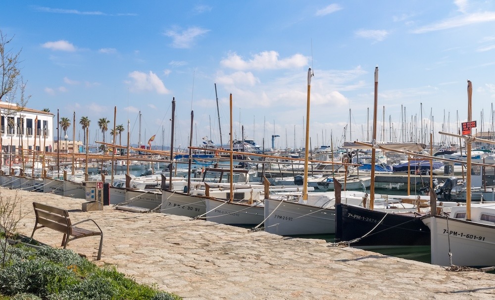
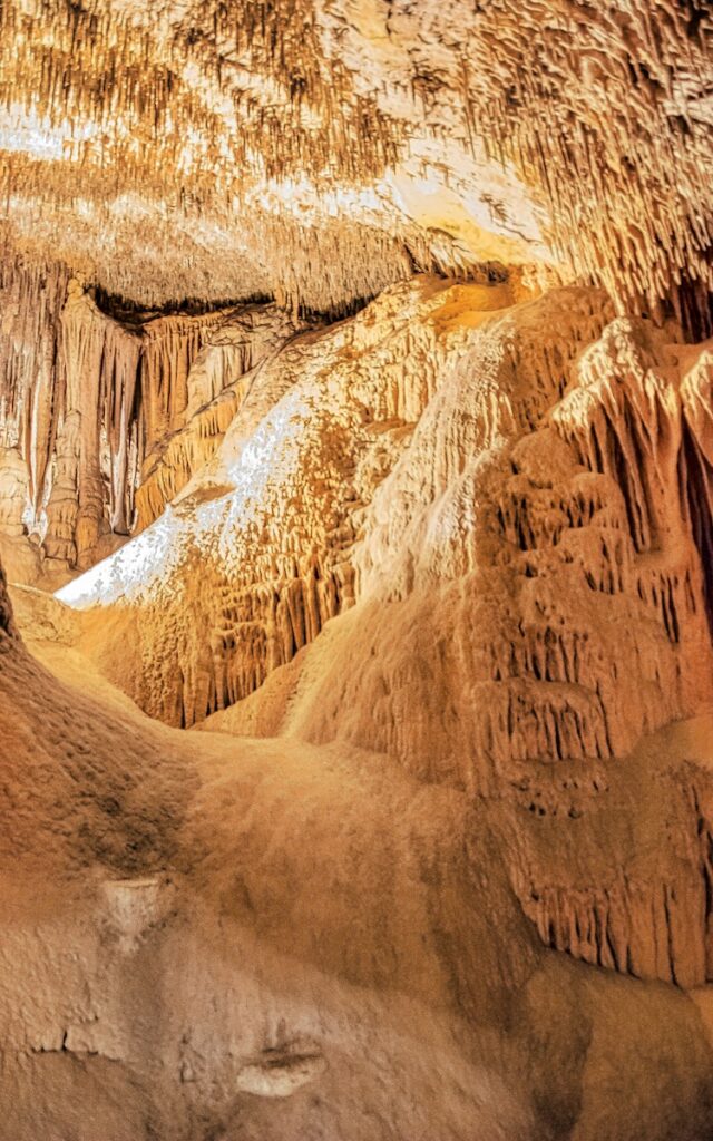
Day 5 – Betlem to Porto Cristo
The leg from Betlem towards Porto Cristo runs along Mallorca’s north-east and east coasts, passing a mix of low headlands, sandy bays, and the odd resort cluster. You have enough distance for a decent sail without it becoming a slog. In moderate onshore winds you’ll see some chop, but nothing a 40–50 foot yacht can’t handle with reefs as needed. As you approach Porto Cristo, the coastline becomes more indented, with cliffs and caves carved into the rock. The harbour entrance is a narrow cleft, leading into a long, protected inlet lined with houses, boats, and the marina. It feels like slipping into a natural fjord, only warmer and with more ice cream. Once inside, the water is calm and the town wraps around you on both sides.
25 nautical miles
4hrs 30mins sailing time
LUNCH STOP:at one of the many bays on route
MOORING:Club Nàutic and public marina berths; water, power, fuel available; contact marina for up-to-date tariff.
Description
The leg from Betlem towards Porto Cristo runs along Mallorca’s north-east and east coasts, passing a mix of low headlands, sandy bays, and the odd resort cluster. You have enough distance for a decent sail without it becoming a slog. In moderate onshore winds you’ll see some chop, but nothing a 40–50 foot yacht can’t handle with reefs as needed. As you approach Porto Cristo, the coastline becomes more indented, with cliffs and caves carved into the rock. The harbour entrance is a narrow cleft, leading into a long, protected inlet lined with houses, boats, and the marina. It feels like slipping into a natural fjord, only warmer and with more ice cream. Once inside, the water is calm and the town wraps around you on both sides.
Attractions
Porto Cristo is best known for its caves. The Caves of Drach feature underground lakes, guided tours, and atmospheric lighting; the Caves of Hams offer another impressive limestone system nearby. Both are easy to reach from the marina by short taxi ride or organised tour. In town, you’ll find a beach near the harbour, seafront cafés, and a pleasant waterfront promenade. The marina area has restaurants, shops, and good provisioning options, so this is a sensible resupply point for fresh food and any small bits of gear. If you’ve been keeping the crew on simple galley food, this is the night to reward them with a proper dinner ashore; I once promised “just a quick tapas plate” here and somehow we ended up sampling half the menu.
Cautions
Narrow entrance; follow marked channel and avoid entry in strong onshore swell if conditions deteriorate.
Facilities
Water, fuel, electricity, showers, Wi-Fi, supermarkets, restaurants, car hire, medical services and pharmacy nearby.
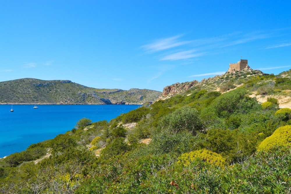
Day 6 – Porto Cristo to Cabrera National Park
This is your longest leg, so it’s worth shaping the day around a proper break. You leave Porto Cristo along the east coast, watching the string of calas slide past as the land gradually flattens. Once you’re settled into the groove, aim for a midday swim and lunch stop in a sheltered south-east cove such as Cala Mondragó, where pine trees, pale sand, and clear water make a perfect pause in settled conditions. After a swim and something simple from the galley, you’ve reset the crew before the more open-water stretch down towards Cabrera. From there the coast slowly drops astern and the low outline of the park rises ahead, until the main bay and its ring of mooring buoys come into view and the boat shifts from passage mode back to quiet-anchorage rhythm. Cabrera’s main harbour is a wide natural bay with steep, scrub-covered slopes and a small fort above the anchorage. Mooring is strictly on colour-coded buoys; anchoring is restricted to protect seagrass beds. Once you’re settled, the atmosphere feels very different from Mallorca’s mainland harbours: no big hotels, little light pollution, and a strong sense of being in a national park rather than a resort.
30 nautical miles
5hrs 30mins sailing time
LUNCH STOP:Cala Mondragó
MOORING:Book colour-coded mooring buoy via CAIB reservation system; fees vary by boat length and season.
Description
This is your longest leg, so it’s worth shaping the day around a proper break. You leave Porto Cristo along the east coast, watching the string of calas slide past as the land gradually flattens. Once you’re settled into the groove, aim for a midday swim and lunch stop in a sheltered south-east cove such as Cala Mondragó, where pine trees, pale sand, and clear water make a perfect pause in settled conditions. After a swim and something simple from the galley, you’ve reset the crew before the more open-water stretch down towards Cabrera. From there the coast slowly drops astern and the low outline of the park rises ahead, until the main bay and its ring of mooring buoys come into view and the boat shifts from passage mode back to quiet-anchorage rhythm. Cabrera’s main harbour is a wide natural bay with steep, scrub-covered slopes and a small fort above the anchorage. Mooring is strictly on colour-coded buoys; anchoring is restricted to protect seagrass beds. Once you’re settled, the atmosphere feels very different from Mallorca’s mainland harbours: no big hotels, little light pollution, and a strong sense of being in a national park rather than a resort.
Attractions
Cabrera is all about nature and quiet. You can hike marked trails up to the castle for views across the archipelago, or walk to the small museum and visitor centre to learn about the island’s history and ecology. Snorkelling is excellent in clear water, where you’ll often see fish over Posidonia meadows and rocky bottoms. Organised visits sometimes include the famous Blue Cave on a park-approved boat; this depends on season and weather, so check availability when you secure your buoy booking. There are no big restaurants or shops here, so you’ll be cooking aboard. If something goes slightly wrong with dinner, the setting is forgiving; I once started diner prep late in a similar park due to the distractions of nature, and the crew still remembers the stars, not the meal.
Cautions
Anchoring largely prohibited to protect Posidonia; follow buoy allocation rules and daytime park regulations carefully.
Facilities
Very limited shore facilities; no fuel, basic water only, bring provisions and medical supplies from Mallorca.
Day 7 – Cabrera to Palma de Mallorca
Leaving Cabrera’s quiet mooring field, you ease north into open water with Mallorca gradually sharpening on the horizon. It’s a steady passage, and with around five hours under way there’s room for a break. A popular choice is a midday swim stop at Es Carbó or Es Caragol, two protected south-coast beaches near Cap de Ses Salines. In calm weather they offer white sand, shallow turquoise water, and enough shelter to drop the hook for lunch without breaking the rhythm of the day. It’s a simple pleasure: a swim, a quick bite, then sails up again for the final stretch. As you close the bay, traffic builds: ferries, cruise ships, local yachts, and training boats. The cathedral and Castell de Bellver become clear landmarks as you shape up for your chosen marina. The contrast from Cabrera’s dark, starry nights to Palma’s lights feels sharp but satisfying; you’ve had both the quiet national park experience and the convenience of a major yachting hub in one Mallorca Sailing loop.
28 nautical miles
5hrs sailing time
LUNCH STOP:Es Carbó or Es Caragol
MOORING:Multiple marinas (Port de Mallorca, RCNP, D-Marin Palma Cuarentena); book ahead and confirm berth prices.
Description
Leaving Cabrera’s quiet mooring field, you ease north into open water with Mallorca gradually sharpening on the horizon. It’s a steady passage, and with around five hours under way there’s room for a break. A popular choice is a midday swim stop at Es Carbó or Es Caragol, two protected south-coast beaches near Cap de Ses Salines. In calm weather they offer white sand, shallow turquoise water, and enough shelter to drop the hook for lunch without breaking the rhythm of the day. It’s a simple pleasure: a swim, a quick bite, then sails up again for the final stretch. As you close the bay, traffic builds: ferries, cruise ships, local yachts, and training boats. The cathedral and Castell de Bellver become clear landmarks as you shape up for your chosen marina. The contrast from Cabrera’s dark, starry nights to Palma’s lights feels sharp but satisfying; you’ve had both the quiet national park experience and the convenience of a major yachting hub in one Mallorca Sailing loop.
Attractions
Palma rewards anyone who steps off the boat for a few hours. Start with La Seu, the island’s Gothic cathedral, towering over the waterfront and famous for its rose window and Gaudí touches. A short walk away sits the Royal Palace of La Almudaina, partly Roman in origin and still hosting official ceremonies. The lanes of the old town hide courtyards, galleries, bakeries, and shaded café corners perfect for a slow wander. For a switch from stone and history, the Arab Baths offer one of the few surviving Moorish sites on the island, set in a quiet garden. If the crew still has energy, you can taxi 10 minutes uphill to Castell de Bellver, a rare circular fortress with panoramic views across Palma and the bay. For food, Santa Catalina’s tapas bars and the Mercat de l’Olivar deliver everything from seafood to local pastries.
Cautions
Heavy traffic in Bay of Palma; watch ferries, cruise ships and training yachts, monitor VHF and keep clear.
Facilities
Full-service yachting hub: water, fuel, power, repairs, supermarkets, restaurants, hospitals, pharmacies, and excellent transport links.
Facilities Summary
Stop
Water
Fuel
Power
Groceries
Restaurants
Medical/Pharmacy
Palma de Mallorca
✅
✅
✅
Large
Many
Full services
Port d’Andratx
✅
✅
✅
Medium
Many
Clinic, pharmacy
Port de Sóller
✅
✅
✅
Medium
Many
Clinic, pharmacy
Cala Sant Vicenç
Limited
⚪
Limited
Small
Several
Basic nearby
Betlem / Colònia Sant Pere
Limited
⚪
Limited
Small
Few
Limited nearby
Porto Cristo
✅
✅
✅
Medium
Many
Medical centre
Cabrera National Park
Limited
⚪
⚪
None
Very few
Bring supplies
Palma de Mallorca (end)
✅
✅
✅
Large
Many
Full services
Consider the Reverse Route
Running this Mallorca Sailing route clockwise, as described, makes good use of typical seasonal patterns. In spring, early summer, and September, afternoon sea breezes and generally light to moderate winds favour a progression from Palma down the southwest coast, along the Tramuntana, then across the north and east before finishing with Cabrera and an open-water return to Palma. The north-west coast between Andratx and Sóller is one of the more exposed sections, so tackling it earlier in the week lets you choose a good weather window rather than feeling pressured late in the trip. A counter-clockwise loop would put that stretch near the end and might force a compromise if a mistral-driven swell arrives in the Gulf of Lion. Finishing via Cabrera works well either way, but in this direction you approach the park from the east coast with time in hand, then enjoy a straight shot back to Palma on your final day. Given current wind statistics and typical cruising advice, I’d stick with the clockwise plan for most crews.
Support Aids
Whether chartering or welcoming friends onboard your own yacht, these FREE KiwiSailor aids will come in handy and help ease your preparations ….meaning the first drink on this journey is so much more enjoyable:
There are so many variables to consider when planning an itinerary and estimating sailing times and distances, so one needs to appreciate that these are an estimate only.
Read MoreLess
Planned Stopping Locations
As they say, you always plan to ‘sail toward’ and not ‘sail to’, as something unplanned could happen. So one should also consider a ‘bolt-hole’ (a sheltered location where a you can find refuge from bad weather for example). I have not planned for these as there are naturally many variables and options to allow for. So look ahead in the plan and always keep an eye on the weather.
Sailing Distance
I use a planning method that adds a safety margin and thus produces a distance, which tends to be 10–20% longer than charted straight-line or optimised-tool calculations. Assuming:
clearing headlands
tacking angles in light wind
staying outside rocky headlands/fringes
not hugging the coastline
Sailing Time
Sailing time is obviously a function of distance and speed, and again speed can vary considerably. My approach here assumes:
round to the nearest 30 mins
relatively clean hull
a cruising speed of 6 knots, which provides small allowances for:
leaving and entering harbours (but ignore berthing or for example anchoring drop/retrieval time)
trimming sails
occasional lulls
motor sailing if wind is too light to maintain 6 knots
Ultimately my approach is to allow for “steady” sailing as you would normally on vacation, rather than sporty Saturday racing at the local club.
To provide the best experiences, we use technologies like cookies to store and/or access device information. By clicking Accept you are consenting to these technologies and this will allow us to process data such as browsing behaviour or unique IDs on this site. By clicking the close button ‘X’ you will not be consenting, which may adversely affect certain features and functions.
Functional
Always active
The technical storage or access is strictly necessary for the legitimate purpose of enabling the use of a specific service explicitly requested by the subscriber or user, or for the sole purpose of carrying out the transmission of a communication over an electronic communications network.
Preferences
The technical storage or access is necessary for the legitimate purpose of storing preferences that are not requested by the subscriber or user.
Statistics
The technical storage or access that is used exclusively for statistical purposes.The technical storage or access that is used exclusively for anonymous statistical purposes. Without a subpoena, voluntary compliance on the part of your Internet Service Provider, or additional records from a third party, information stored or retrieved for this purpose alone cannot usually be used to identify you.
Marketing
The technical storage or access is required to create user profiles to send advertising, or to track the user on a website or across several websites for similar marketing purposes.